
Monitoring Methods
Sediment
- Sediment Pins
- Sediment Plates
- Marker Horizons
- Surface Elevation Tables (SETs)
- Soil Characteristics
- References
Join the Discussion
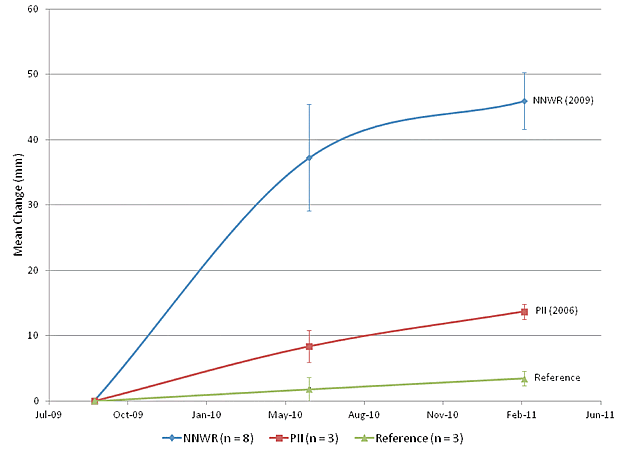
Surface Elevation Table
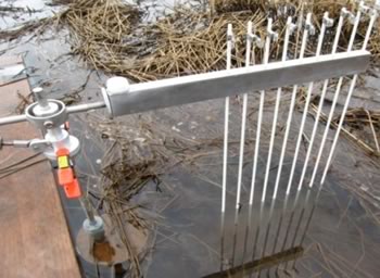
Description: Portable mechanical leveling device for measuring relative sediment elevation changes. Is often paired with marker horizon to explain processes behind elevation increases or decreases (i.e. sedimentation, shallow subsidence, etc.)
Benefits: accurate and precise as measurements are always taken in the exact location, mm resolution
Limitations: expensive to install, sedimentation rates limited to where poles are installed, poles can sometimes cause erosion in unvegetated areas.
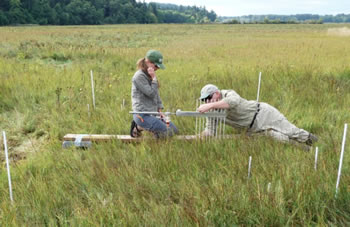
Installation and Measurement Methods: Currently, the most comprehensive source for SET background, installation and measurements can be found at the USGS Patuxent Wildlife Research Center website (http://www.pwrc.usgs.gov/set/)
Data Entry and Analysis: For examples on how to enter and analyze SET data, see (http://www.pwrc.usgs.gov/set/readSET.html and http://www.nisquallydeltarestoration.org/science_geomorphology_sedimentation.php)