
Monitoring Design: Spatial Scale
While restorations are typically designed, implemented and managed individually, at the local project or site level, estuary-wide responses to restoration actions can also be measured. As such, project objectives can be designed to examine two scales of interest.
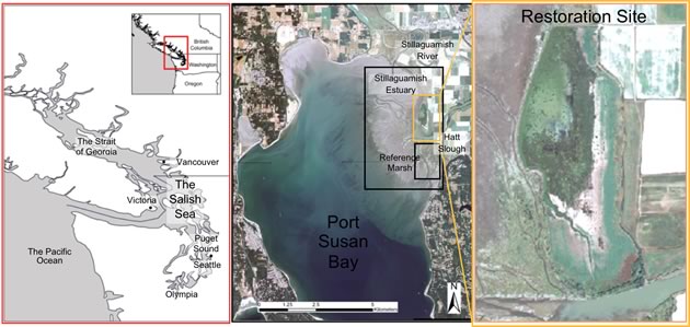
Site-scale: This scale includes the restoration site and reference marsh, and is intended to examine the development of habitat and functions on the footprint of the project. A similar-sized reference marsh will allow the development of the restored marsh to be compared with a marsh that has never been diked. Site-scale may also include multiple restoration sites within a single estuary or bay.
Estuary-scale/Landscape-scale: This scale describes the overall influence of the restoration action on the entire estuary ecosystem landscape. For example, we may find project effects on estuary-scale processes such as the distribution of freshwater and sediment.